Category:Chadwell St Mary
Jump to navigation
Jump to search
English: Chadwell-St-Mary is a dispersed settlement in the unitary authority of Thurrock in Essex, England. It is one of the traditional (Church of England) parishes in Thurrock and former civil parish. It is a few miles east of the town of Grays and is located north of the modern town of Tilbury which was part of the parish until the end of the 19th century. It is frequently referred to simply as Chadwell, particularly before the 19th century.
Nederlands: Chadwell St Mary is een plaats in het bestuurlijke gebied Thurrock, in het Engelse graafschap Essex. De plaats telt 9.631 inwoners.
village in Essex, United Kingdom  | |||||
| Upload media | |||||
| Instance of | |||||
|---|---|---|---|---|---|
| Location | Thurrock, Essex, East of England, England | ||||
 | |||||
Subcategories
This category has only the following subcategory.
C
Media in category "Chadwell St Mary"
The following 34 files are in this category, out of 34 total.
-
 Bridleway and footpath junction beside Heath Road - geograph.org.uk - 3242670.jpg 4,288 × 3,216; 7.19 MB
-
 Chadwell Place, Chadwell St Mary - geograph.org.uk - 3242543.jpg 4,288 × 3,216; 7.86 MB
-
 "Three So Wild in Their Attire" - geograph.org.uk - 42309.jpg 640 × 482; 100 KB
-
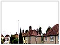
 Chadwell Skyline.JPG 240 × 154; 15 KB
-
 Chadwell St Mary Library - geograph.org.uk - 3188498.jpg 4,288 × 3,216; 5.94 MB
-
 Chadwell St Mary Village Sign - geograph.org.uk - 3188517.jpg 4,288 × 3,216; 6.84 MB
-
Chadwell St Mary.ogg 1.6 s; 17 KB
-
 Church of St Mary's, Chadwell St Mary - geograph.org.uk - 3188550.jpg 4,288 × 3,216; 7.04 MB
-

-
 Cross keys public house, Chadwell St Mary - geograph.org.uk - 3188560.jpg 4,288 × 3,216; 6.69 MB
-
 Defoe Parade, Chadwell St Mary - geograph.org.uk - 2760999.jpg 640 × 427; 91 KB
-
 Drive to Heath Place - geograph.org.uk - 42315.jpg 640 × 482; 117 KB
-
 Former branch, Grays Co-operative Society, Chadwell St Mary.jpg 3,072 × 2,304; 1.27 MB
-
 Gravestone of Yamazaki Kazuo.JPG 3,456 × 4,608; 3.7 MB
-
 Horses at Orsett Heath - geograph.org.uk - 721515.jpg 640 × 408; 60 KB
-
 Junction of Sandy Lane and Linford Road - geograph.org.uk - 6087644.jpg 1,024 × 768; 334 KB
-
 Kevin Sadler GLC.png 472 × 618; 223 KB
-
 Longhouse Road, Chadwell St Mary - geograph.org.uk - 2760991.jpg 640 × 427; 69 KB
-
 Neil Wright.JPG 3,008 × 2,000; 1.59 MB
-
 Palmers College - geograph.org.uk - 39601.jpg 640 × 482; 117 KB
-
 Path in St Mary's Cemetery - geograph.org.uk - 3242663.jpg 4,288 × 3,216; 7.25 MB
-
 Ring o' roses, Chadwell St Mary - geograph.org.uk - 2499319.jpg 640 × 480; 129 KB
-
 Riverside Methodist Church, Chadwell St Mary - geograph.org.uk - 3242549.jpg 4,288 × 3,216; 5.07 MB
-
 Roundabout below Chadwell Hill - geograph.org.uk - 3188581.jpg 4,288 × 3,216; 6.05 MB
-
 Roundabout on Linford Road (2) - geograph.org.uk - 3188492.jpg 4,288 × 3,216; 6.7 MB
-
 Roundabout on Linford Road - geograph.org.uk - 3188475.jpg 4,288 × 3,216; 6.63 MB
-
 Scott Road 1990 - geograph.org.uk - 2680691.jpg 641 × 488; 51 KB
-
 Scott Road In The Nineties - geograph.org.uk - 2705744.jpg 800 × 600; 72 KB
-
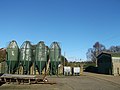 Silos and Barn, Chadwell Place Farm - geograph.org.uk - 3242517.jpg 4,288 × 3,216; 6.73 MB
-
 St Mary's Cemetery, Chadwell St Mary - geograph.org.uk - 3242657.jpg 4,288 × 3,216; 6.64 MB
-
 St Mary's, Chadwell St Mary - geograph.org.uk - 3809116.jpg 640 × 480; 45 KB
-
 Sunspan.JPG 1,000 × 709; 172 KB
-
 The church, Chadwell St Mary - geograph.org.uk - 2501280.jpg 640 × 480; 107 KB
-
 Woodside and Tyrells Heath.jpg 1,152 × 864; 263 KB


_-_geograph.org.uk_-_3188492.jpg)


